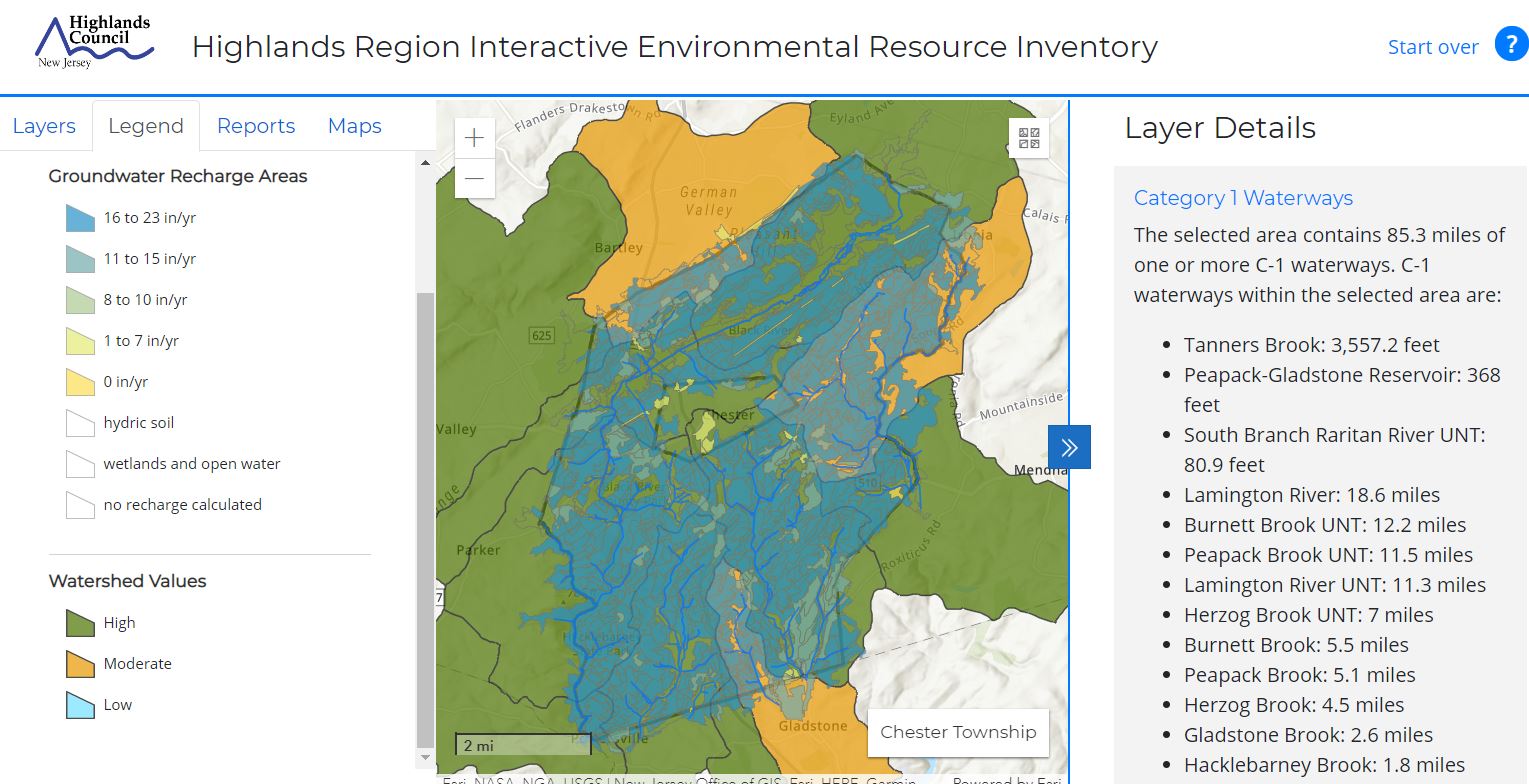
The Highlands Interactive Environmental Resource Inventory (ERI) is a map-based application designed to assist in the development of municipal ERIs. The application can be used to view and export maps and associated narratives describing a wide range of environmental and other resource data for the Highlands Region. The application pulls data directly from a variety of sources, ensuring the best currently available data is always being presented.
Attend this 90-minute introduction and training session to learn more about using the Interactive ERI. The webinar will provide an overview of application content, features, navigation and tools and demonstrations on how to use the application for site-specific reviews and to build the foundation of a municipal ERI.
Presenters: