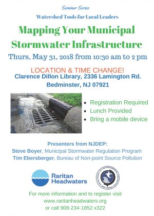
 Mapping Your Municipal Stormwater Infrastructure
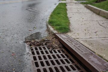
The NJDEP has developed a new stormwater mapping tool to assist municipalities with meeting the requirements of their municipal stormwater permit. This ArcGIS Online field app (Collector for ArcGIS) is available free-of-charge to municipalities as well as to partners* authorized by the municipality. Presenters from NJDEP, Steve Boyer and Tim Ebersberger, will provide a hands-on training to learn how to use this new stormwater mapping tool. The workshop will also include an overview of the recently renewed municipal stormwater permit requirements, as well as a short presentation on how to visually assess the quality of existing stormwater infrastructure.
*If you are a member of an environmental organization and you would like to assist with stormwater mapping in your area, it is recommended that you reach out to your local municipal stormwater coordinator because the tool is only available to municipalities.