Water Quality
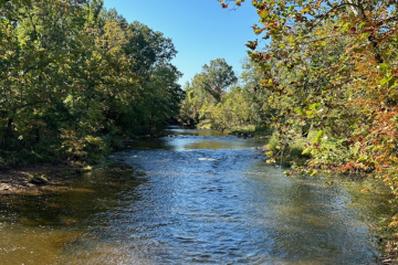
Blurb about the site.
Short description about the letter grade B and what it means. Description about the wheel’s colors and grades for each parameter.
Problems in our watershed that could be affecting this site. Is there something basic we can put together that goes with each grade. That way it can just be copied and pasted?
The North and South Branch Raritan Watershed and all its subwatersheds and 64 active monitoring sites receive ratings for their averaged and individual High Gradient Macroinvertebrate Index (HGMI) scores. HGMI is a metric of water quality and stream health based the presence or absence of bottom-dwelling stream organisms with known tolerances or intolerances for specific pollutants. For instance, if the only invertebrate species at a stream monitoring site have broad pollution tolerance, and no species which only inhabit streams of high water quality the monitoring site would receive a lower HGMI score and rating for stream health. Based on a scale of 0 to 100, HGMI ratings are grouped as Excellent (63 – 100), Good (<63 to 42), Fair (<42 to 21), and Poor (<21). Raritan Headwater Association data on HGMI and other water quality chemical, bacterial, and habitat metrics are used by the NJ Department of Environmental Protection and the US Environmental Protection Agency to compare our watershed health with state and national standards, such as the Clean Water Act. To read more about our stream monitoring program and water quality reports, go to (https://www.raritanheadwaters.org/monitoring-water/surface-water/).
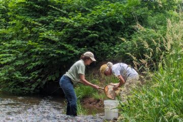
What is being monitored at this site?
Threats and Recommendations
information about threats and icons for the threats.
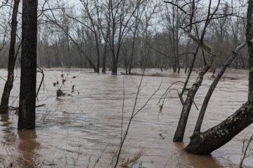
Pollutants enter the water from two main types of sources: point sources or non-point sources of pollution. A point source is a single, identifiable source of pollution, such as a pipe or a drain. Industrial wastes, municipal treated wastewater, and stormwater are commonly discharged to rivers in this way. Non-point sources of pollution, the most common source of pollutants in our surface and groundwater, generally refer to areas where pollutants can enter the watershed but are not easily attributed to a single source. Different forms of land use— including the three main land uses in our watershed: urban, agriculture, and forestry land uses—contribute different forms of non-point source pollutants. These areas can contribute pollutants like car oil, fertilizers, pesticides, and soil erosion and sediment run-off, especially after heavy rainfall events. To learn more about the threats facing our watershed, read about our surface water monitoring program (https://www.raritanheadwaters.org/monitoring-water/surface-water/).