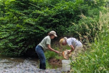
A fun mapping and observation activity
Find out what watershed your yard is in, draw a map of your yard and then see where the water goes! Created by Lauren Theis, Director of Education.
Level: Elementary to Adult
Duration: 40 minutes to 2 hours
Setting: Inside your house and in your backyard
Materials:
- Drawing Paper
- Pencils, Crayons
- A clipboard or hard surface to write on while outside
- A golf ball, tennis ball, bouncy ball, or other small “rolly” item
- Optional: A yard stick and long piece of string
Background Information:
Water is always moving through the water cycle. Some of the ways we can observe water moving is through evaporation, precipitation, and when it runs over surfaces like a roof, driveway, or lawn (this is also called stormwater runoff). Since we all live in a watershed, how we treat the water on our property affects everyone (and everything)! Water flows from high points to low points through the force of gravity, and while it flows, it can pick up pollutants like chemicals and litter.
The Activity:
- Find what sub-watershed you are in by visiting raritanheadwaters.org. You can also find your address on Google Maps and click “Show Terrain” to see the ridges and valleys that surround your house. Looking at these maps, can you predict where the water would flow? What is the closest water body to your house?
- Best to do before it rains: Using symbols from the legend below, draw a map of your yard. You can include front and backyard, if you like. If there are water bodies on your property, or storm drains nearby, you should include them too. Option: if there are multiple people working on this, you can divide the yard into sections and then combine them into one map.
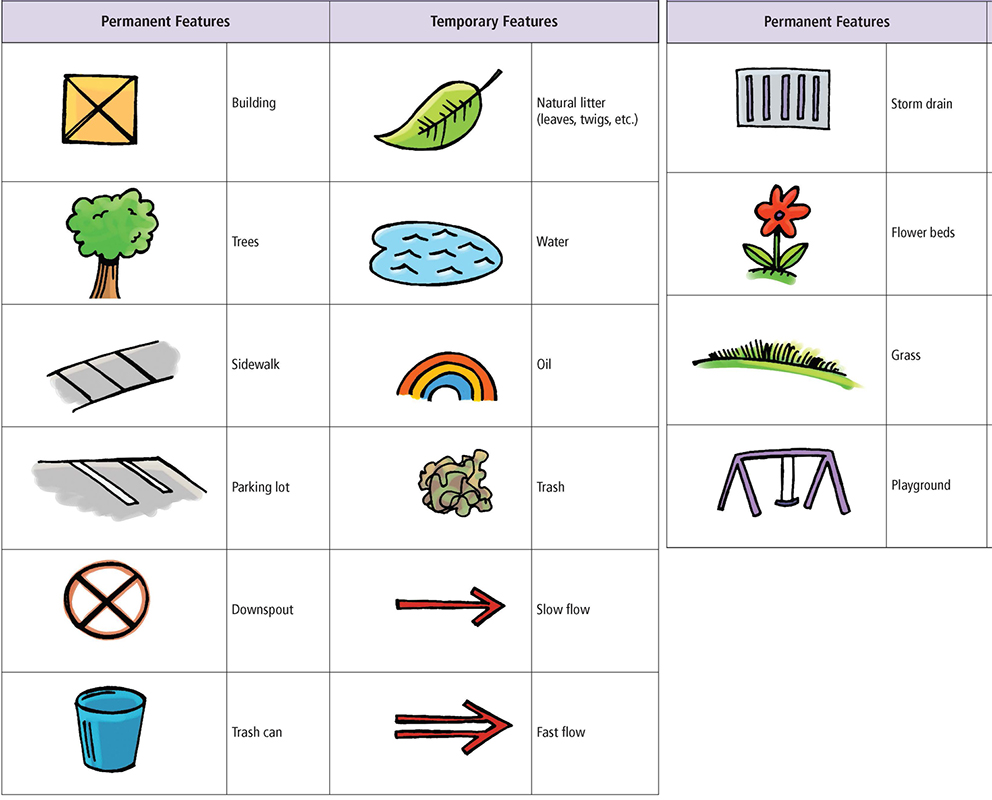
- Predict where the water will flow when it rains. Indicate water flow on your map with arrows. Can you determine where the water from your roof goes? What about your driveway, or other “impervious” surfaces? Watch where your ball rolls on these surfaces to see if you’re right!
- Next time it rains, see if your predictions were correct! Discuss reasons for discrepancies.
- Are there any pollutants that water might pick up as its flowing through your property? What are some things you can do to keep the water in your yard clean before it returns to the water cycle?
Challenge: Using a topographical map (Google Maps), can you predict where the water flows after it leaves your yard? Trace the water’s route from high to low over the ground. What water body do you think it will enter? Do any human activities or land uses in the waters’ path affect it positively or negatively?
Lesson adapted from Rainy Day Hike – Project WET Curriculum and Activity Guide. The Watercourse and Council for Environmental Education (CEE).
How did you like this activity? Please share any questions, comments, or photos that you and your child have on the Raritan Headwaters Learning Community Facebook Page!
More Raritan Headwaters Learning Resources